
Quantitative geographer and systems architect building at the intersection of satellite telemetry, computational terrain science, and edge vision AI.
Featured Work & Systems
Production platforms, spatial engines and open-source software
 Live Platform
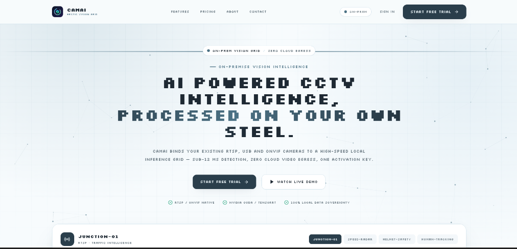
CamAI — Visual Intelligence Ecosystem
2026End-to-end edge surveillance and real-time vision telemetry platform. Powered by TensorRT FP16, ByteTrack Re-ID, and FastAPI microservices. Currently in enterprise negotiations.
Brownfield-to-Solar PV Reclamation
2025–Present3D terrain and techno-economic suitability modeling to repurpose a decommissioning open-cast mine into a utility-scale solar park. Slope/aspect masking (< 5°), shadow analysis, and GHI yield calculations.
AutoGIS Studio — Autonomous Desktop AI
PyQGIS-powered AI desktop assistant for QGIS. Translates natural language prompts into automated spatial queries, layer styling, and satellite data retrieval. Multi-LLM provider support.
GeoLibre India GIS Plugin
Core open-source contribution enabling regional dataset search, automated boundary ingestion, and India-specific spatial queries in the Tauri v2 + React desktop GIS stack.
Peer-Reviewed & Empirical Research
Himalayan hazard modeling, satellite remote sensing and GLOF dynamics
Community Isolation Risk along the NH-7 Himalayan Transport Corridor
Prince (Lead Spatial Researcher) • Department of Geography, University of Delhi • Sept 2026
Evaluated accessibility exposure across 3,419 settlements within a 15 km NH-7 buffer. Multi-criteria framework: Road Accessibility (46.91%), Healthcare Proximity (20.10%), NH-7 Proximity (20.10%), Slope (8.62%), Elevation (4.27%). Validated with in-situ hazard ground-truthing in Rudraprayag (Mastura landslide corridor).
Nepal Glacial Lake Outburst Flood (GLOF) Early Warning & AI Dynamics
Prince • Advising Faculty: Department of Geography, University of Delhi
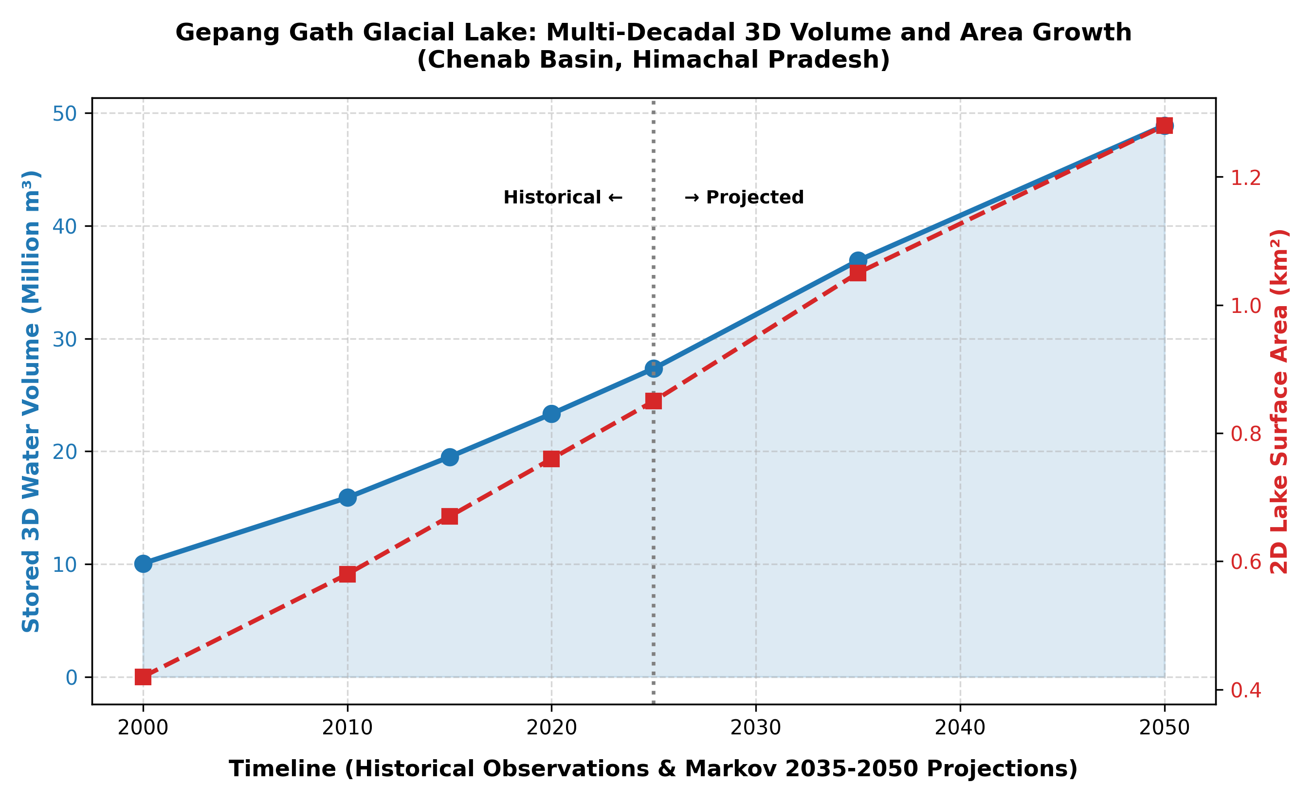
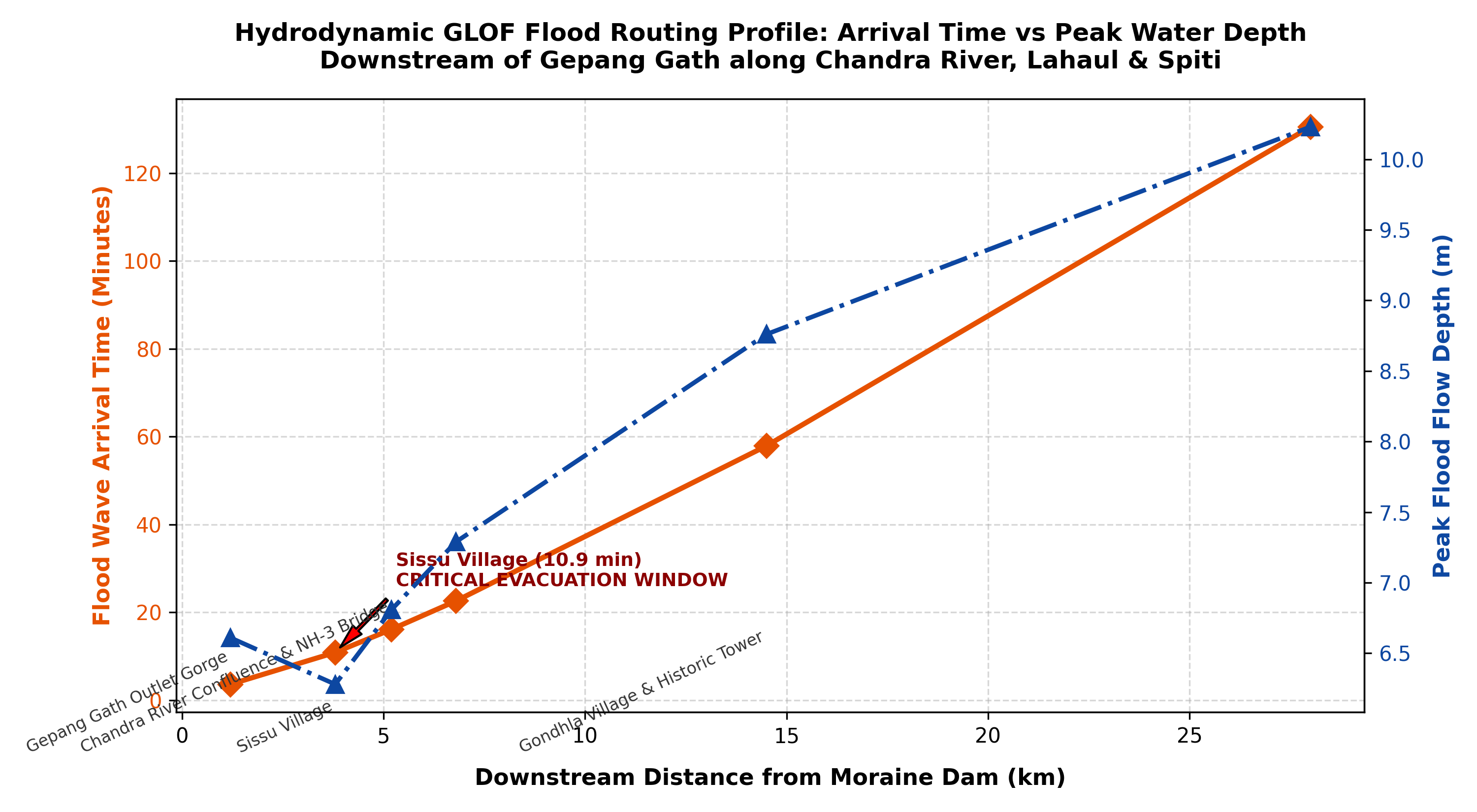
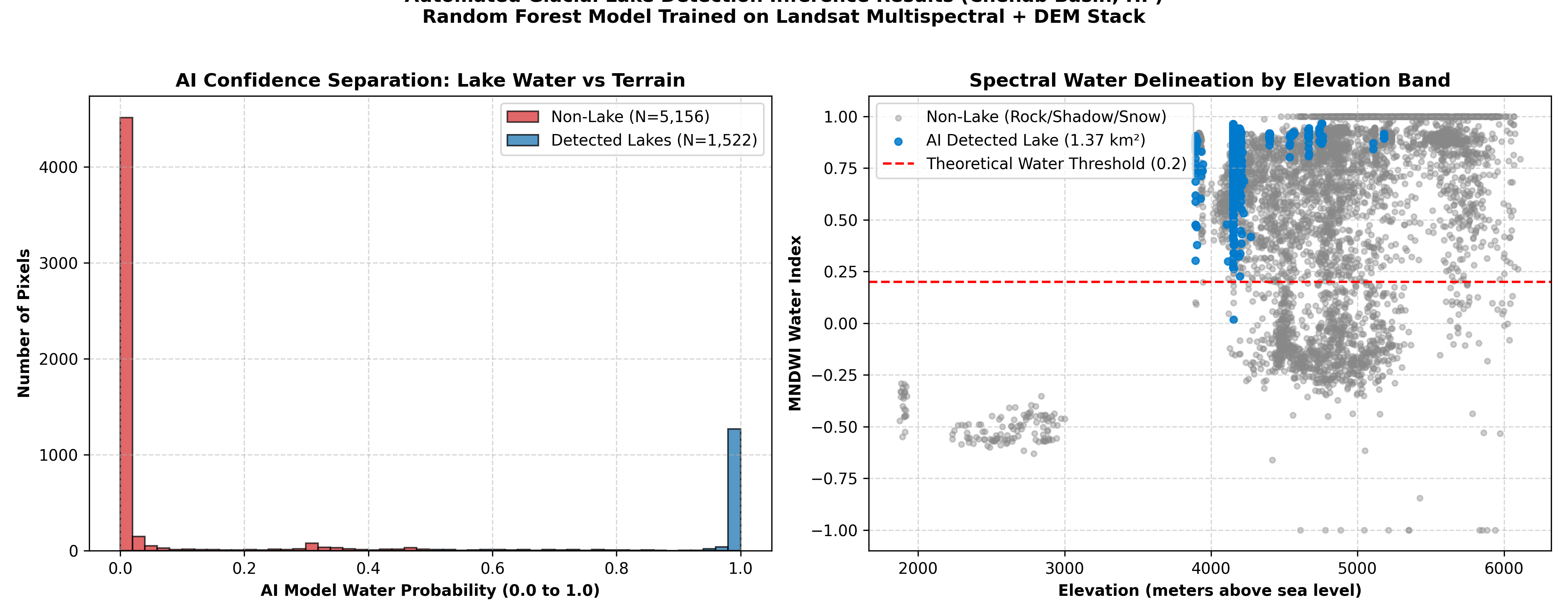
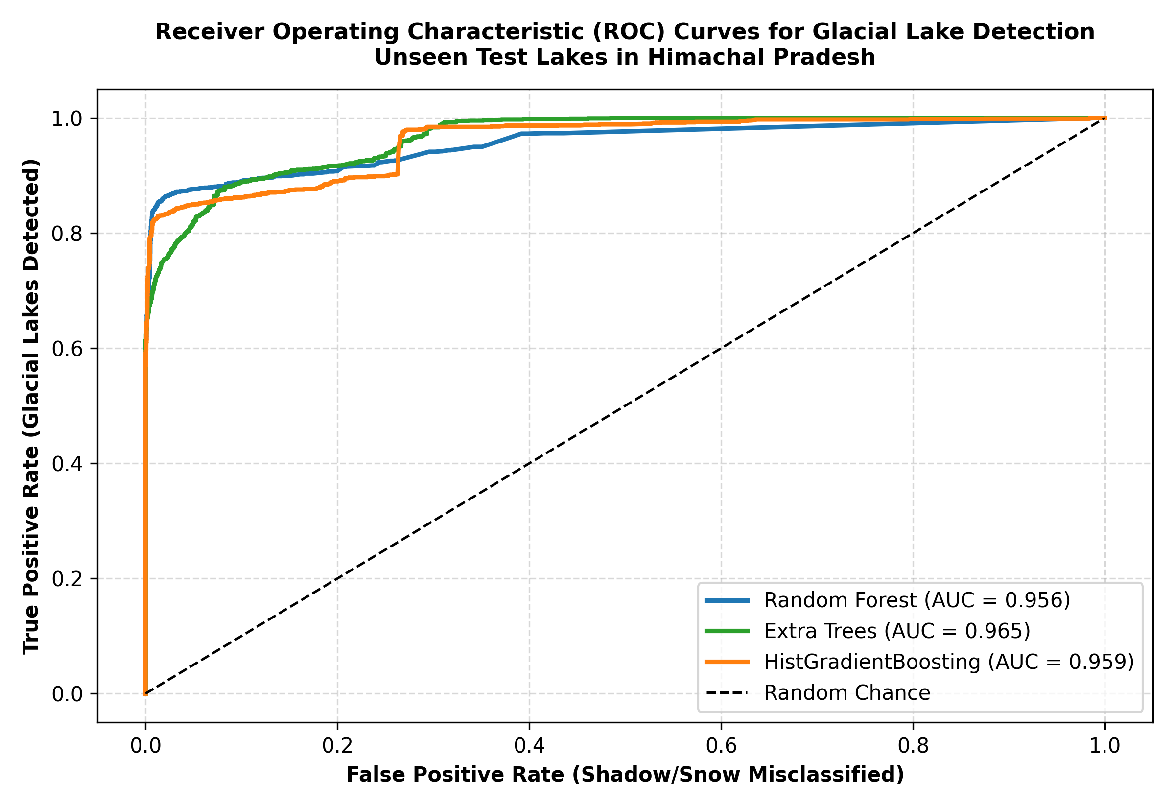
Multi-temporal satellite pipeline combining Sentinel-1 SAR (VV/VH polarizations) and Sentinel-2 optical (NDWI/MNDWI) with deep learning segmentation to track moraine-dammed lake expansions.
Expeditions & Fieldwork Stations
Click pins on the map to view in-situ ground-truthing and field sampling stations
Skills & Technical Stack
Technologies and workflows used in daily research and system synthesis
Timeline & Education
Professional trajectory and academic credentials
Engineered real-time vision platform (TensorRT FP16, ByteTrack Re-ID, FastAPI). Currently in enterprise negotiations.
3D terrain suitability and GHI solar modeling for open-cast mine decommissioning; 20+ layer MCDM for Pune utility solar; emergency health isochrones in Ludhiana.
Biomass carbon sequestration modeling and multi-temporal satellite ETL pipelines.
Dr. Bhim Rao Ambedkar College. First Class Standing. Core modules: Remote Sensing & GIS, Geostatistics, Cartography, Geomorphology.
Let's Connect
Open to graduate research, geodata science collaborations, and strategic spatial AI consulting.